POA Purpose
Hey, we live in a big country, a country with countless scenic overviews, lookout points and parkway rest stops. We live a country where millions of people take pictures of canyons, sunsets, waterfalls, sky scrapers and elevated T stops every day. We want everyone to see those pictures.
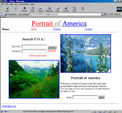
Portrait of America is the first online geospatialized photograph database. Its purpose is to provide free access to images of any part of the country. Using new technology available from Oracle Corporation Portrait of America is able to maintain a database of photographs uploaded by its users.
POA Content
Content is the heart of the Portrait of America. Obtaining content was perhaps the most challenging part of the project. We borrowed from the experience and resources of photo.net in order to acquire initial content as well as create an easy way for users to upload new content.
Users of photo.net requested an easier way to upload multiple images. The POA upload pages allow users to upload as many as five photographs at once (while this isn't a perfect solution, it has made improvement). We also requested that photo.net users enter location data for their images so they can be imported into the POA and have recieved a great response. Oracle's Intermedia allows POA to accept many, many different file types and always serve browser friendly jpeg images.
The Browsing User
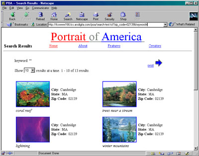
Any internet user can reach the POA at http://poa.mit.edu or http://lcswww166.lcs.arsdigita.com. Once there, users have the ability to search the entire database (except censored photographs) by location (zip code) or key word (in location or caption). Location search results will be ranked by distance (as calculated by Centrus Software ).
Any image that a browsing user sees is also a link to the details of that page including date taken, location taken, contributing user and contributing date. This page also allows the browsing user to view (or retrieve the image) in small, medium or large.
The Registered User
Any user who has an account on the POA can add content to the database. The user can upload photos and coment on photos. In order to really gain user content we attempted to make it as easy as possible to upload photographs.
|
|
|
The Content Administrator
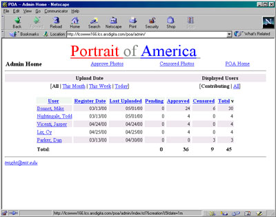
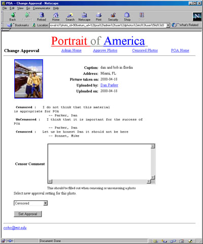
Content Administrators are able to monitor the content growth of the site as well as censor unwanted images. This responsibility was made seperate from the site-wide administration so that in the future it could be delegated to anyone (not just the three of us).
These administrators have access to reports on which users are contributing and when. The reports are geared toward tracking content growth. The administrators also have the ability (reponsibility) to censor any image which would be incriminating to the service (underage pornography), or perhaps even just off topic for the POA (regular pornography).
Technical Comment
The Portrait of America relies heavily on Oracle interMedia. Images are stored in the database as a single object which contains the image data, as well as information about file size, type, compresion, and upload date. An image signature (what the image looks like) is also generated at upload time, and stored with the image. Image signatures can then be compared, and images selected based on their similarity.
Address and zip code searching is done using interMedia Locator and Centrus Software's geocoding service. Geocoding is a process of translating address information in longitude and latitude coordinates. When an image is uploaded, the user enter street address, city, state, and zip code information for that image. This information is then passed to www.centrus-software.com in real-time, and that site returns longitude and latitude coordinates, which are stored in the database. When a user enters a zip code or address to search for, it is geocoded into longitude and latitude. The distance is then calculated between that longitude/latitude and the longitude/latitude stored with each image in the database using standard navigational formula. The photos are then sorted by their distance from the location entered by the user, and displayed.
|
